
APPLICATIONS
The worldwide demand for photogrammetry for high-precision aircraft-based surveys and data-related services (keyword: Smart City) has prompted Elektra Solar GmbH to establish a future-oriented partnership with 3D RealityMaps GmbH from Munich.
In cooperation with our partner 3D RealityMaps GmbH, Elektra Solar exclusively offers special flights with an environmentally friendly, solar-electric powered ultralight aircraft - the Elektra Solar One.
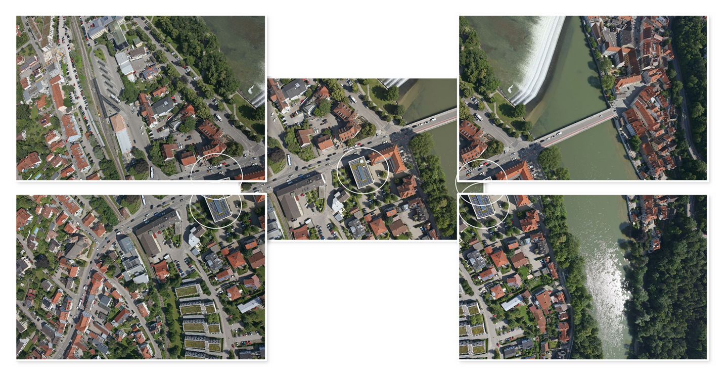
With a newly developed camera system, ortho aerial images, oblique aerial images, surface models, and thermal and multispectral images can be captured in one flight.
These data are used to create virtual 3D city models with the highest level of detail and specialized data for planning tasks, energy efficiency, climate protection and sustainable urban development.
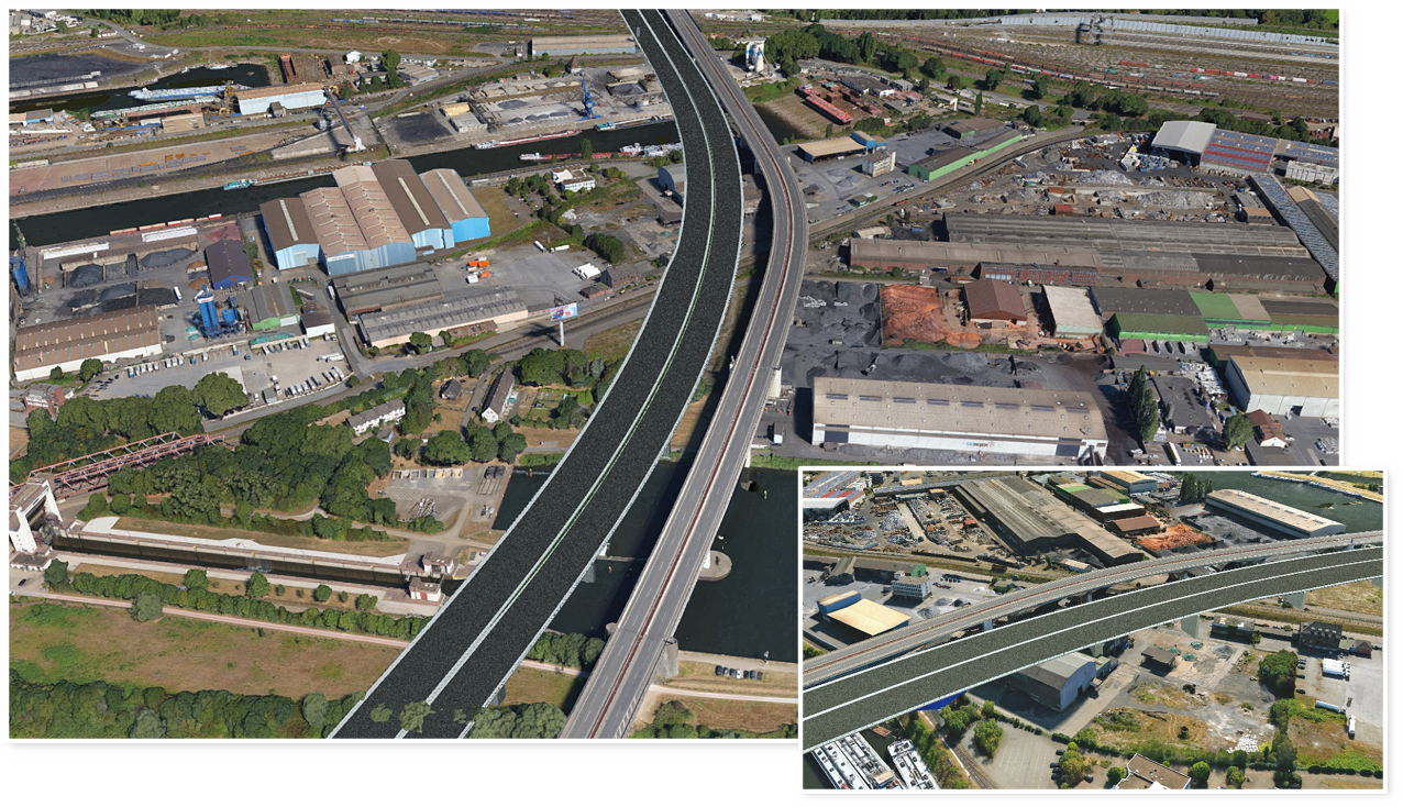
Unlike conventional drones, our manned aircraft do not require ascent permits and can fly over an area of up to 25 km2 in one day. With a flight distance of up to 400 km in one flight, longer motorway sections and railway lines can be digitized quickly and promptly. From a flight altitude of 300 m, the Elektra One aircraft is practically inaudible and therefore does not disturb the residents of the areas to be overflown.
Multiple redundant system components ensure maximum flight safety. Due to lower wind susceptibility than small drones, high-quality images are provided even in less than optimal light and weather conditions.
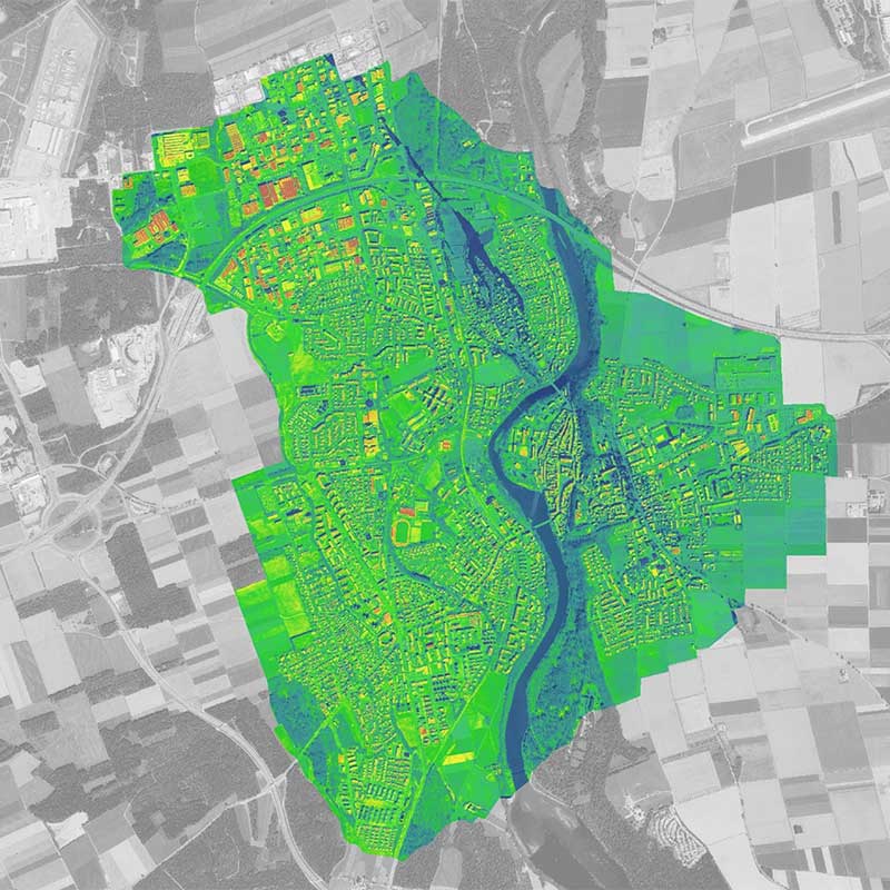
Smart City Concept
Smart cities use modern technologies to network their energy, mobility, urban planning, administration, and communication areas.
With the help of a digital 3D city model urban planning areas measure, traffic flow, the spread of noise and pollutants can be simulated, potential areas for solar energy can be identified, and urban greenery can be optimized.
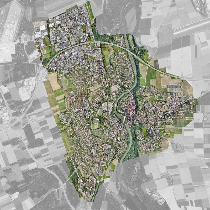
Photo-realistic 3D City Models
Using 3D Reality Maps’ photogrammetric processes, three-dimensional digital models, so-called “digital twins” with the highest resolution and colour fidelity, are created from the aerial images.
These models can be used as a basis in surveying, urban planning or even public safety and can be used to create “smart cities” or “virtual reality” applications.

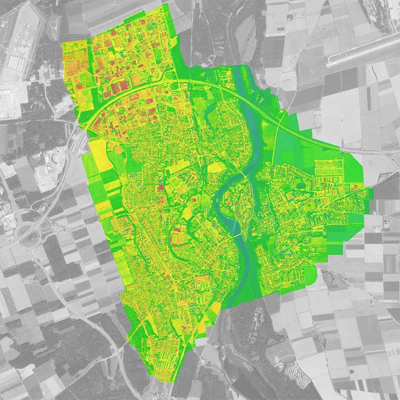
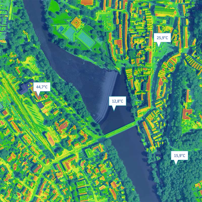
Thermal & multispectral imaging
Using our MSKS thermal imaging camera heat leaks in buildings or defective solar cells can be localized, or the state of health of the vegetation can be evaluated. As a complement, our multispectral imaging camera is optimized for ecological and agricultural applications.
The ability to record 3D surface models, colour and multispectral aerial images, and thermal imaging data in one overflight, is a unique feature of our system.

Aerial geodata acquisition
With solar-electric powered aircraft, we scan your area of your facility emission-free and almost noiselessly. A specially developed autopilot enables accurate tracking of a predefined flight path and exact repetition at later points in time. For image data acquisition, we use five RGB cameras, one (NADIR) camera looks in the vertical line direction, and four other (OBLIQUE) cameras are arranged at an angle for optimum facades coverage.
With the system described, we achieve a ground resolution (GSD) of about 4 cm, which is a factor of two higher than the current standard.

Interactive visualization of construction projects
The digital and photorealistic images are essential building blocks for tenders and future construction projects.
Arbitrary viewing angles, visual axis and analysis, distance measurements combined with video animations allow a virtual tour in planned constructions projects. Already in the planning phase, the effects of the interactive 3D projects can be determined by a sun-shadow analysis on the adjacent, already existing buildings.
Automated data extraction from image information using machine learning
Besides, we offer the possibility of data extraction from image information using AI-based algorithms, for example, the three-dimensional acquisition and classification of vegetation, roof shapes and superstructures building types or street inventory.
Orthophotos
In cooperation with 3D Reality Maps, we created georeferenced orthophotos that depict areas and territories without distortion and true to scale. Communities use orthophotos, municipalities and urban planners for surveying, mapping and the cadastre.


